Limestone Way - Day 3
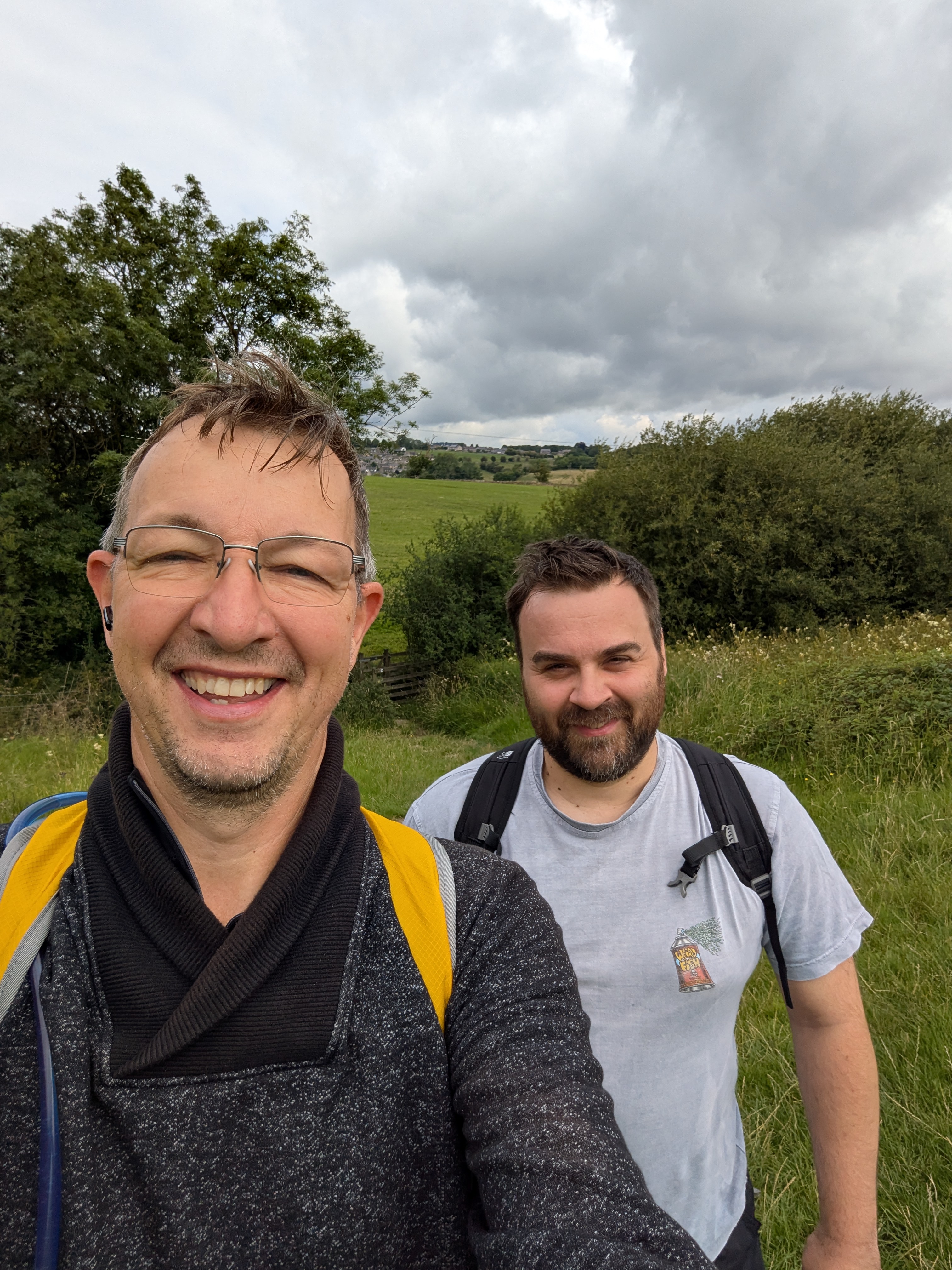
The Limestone Way continued today with a lighter, leaner walking party—just Steven C and myself, setting off from Youlgrave around 11am. Legs a little sore but spirits high, we snapped a quick selfie to mark the start of Day 3, ready for whatever the path (and the Peak District) had in store. The rest of the crew (and Sasha!) were missed, but there was the prospect of ticking off some serious countryside today with the potential of only leaving one more day of walking ahead but those thoughts would be getting far too ahead of ourselves to be considered right now.
Rain, Rock Circles and Robin Hood
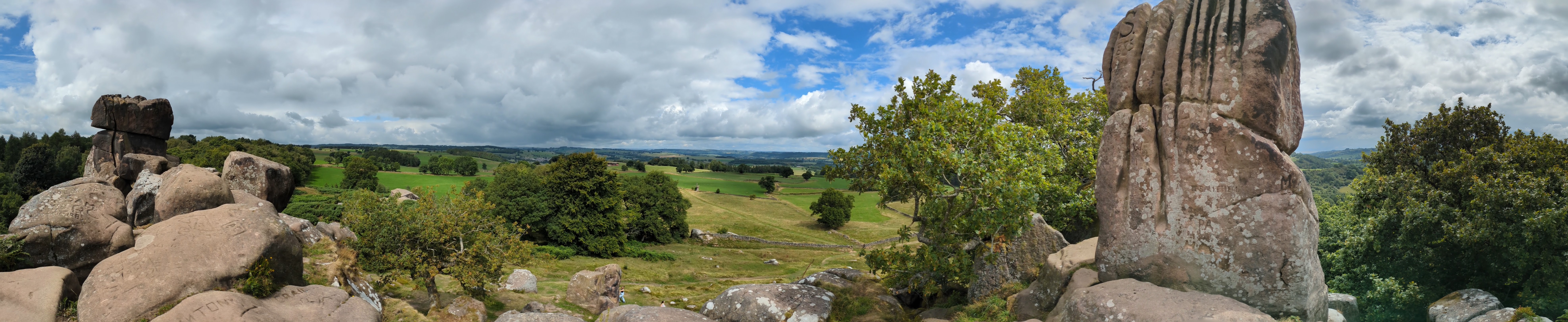
We began in a light drizzle, but with a promising forecast and some exciting features on the route map, we weren’t disheartened. I’d spotted a stone circle just off our route—The Grey Ladies, said to be Bronze Age in origin—and figured it was well worth a detour.
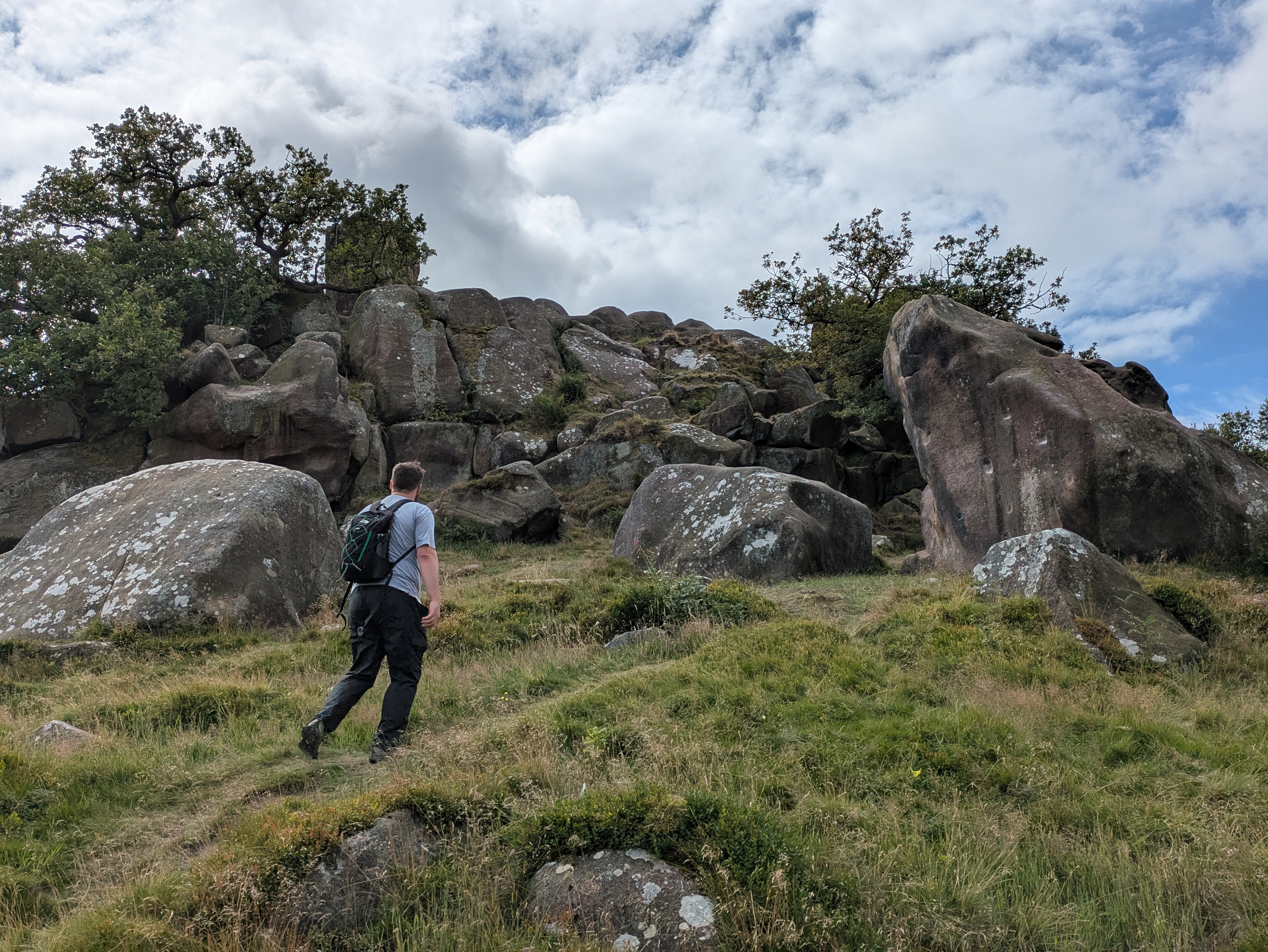
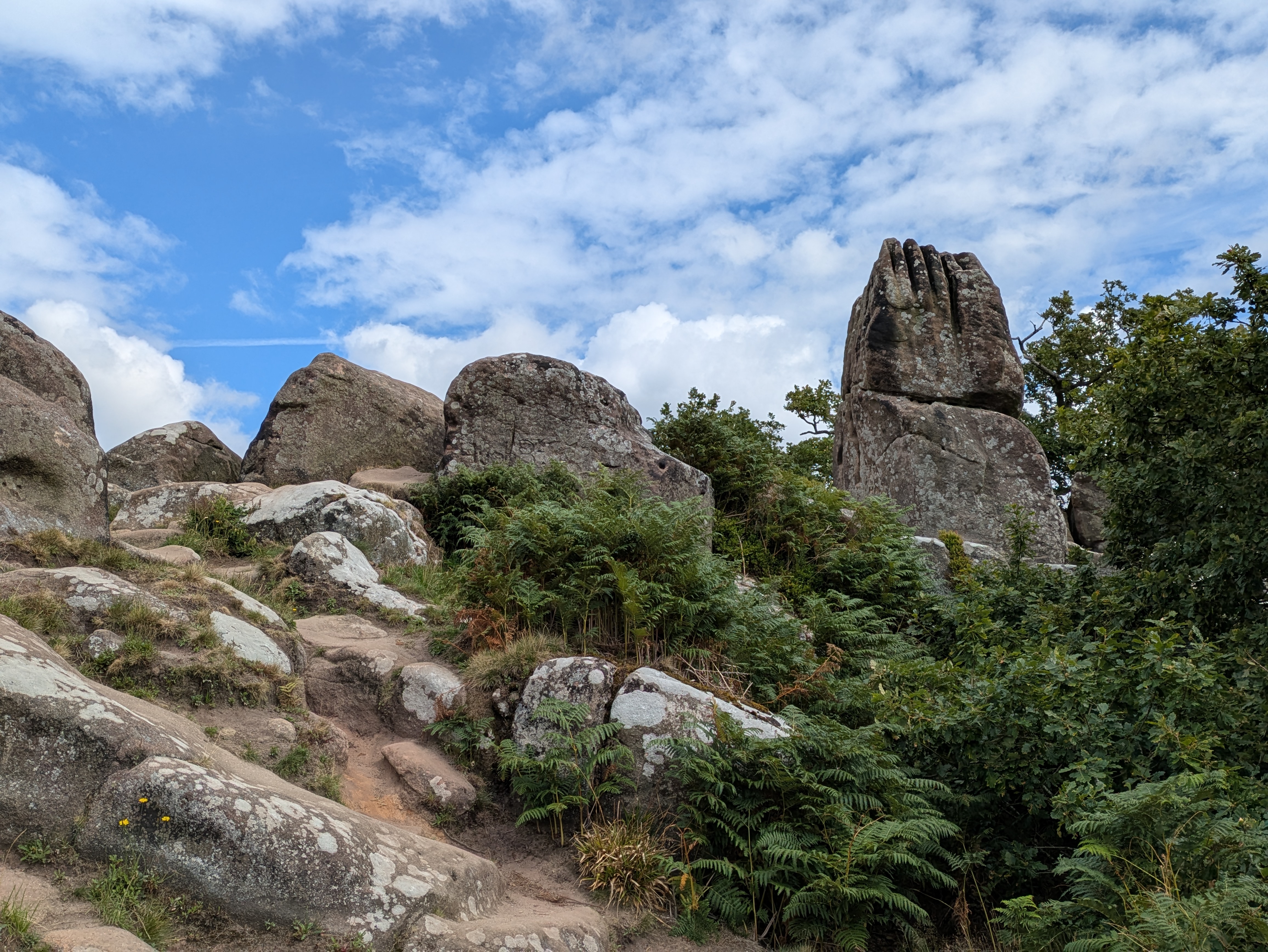
Of course, no good plan survives contact with the trail, and I managed to cut a ridge section by mistake early on. With a bit of backtracking to make up the distance, the Grey Ladies became even more of a priority. As we crossed a field toward them, we spotted a large rock formation off to our right and wondered what that might be. Once at the stone circle, a woman and her dog were quietly enjoying the view, I gently interrupted to ask about the site, and she proved to be a wellspring of local knowledge.
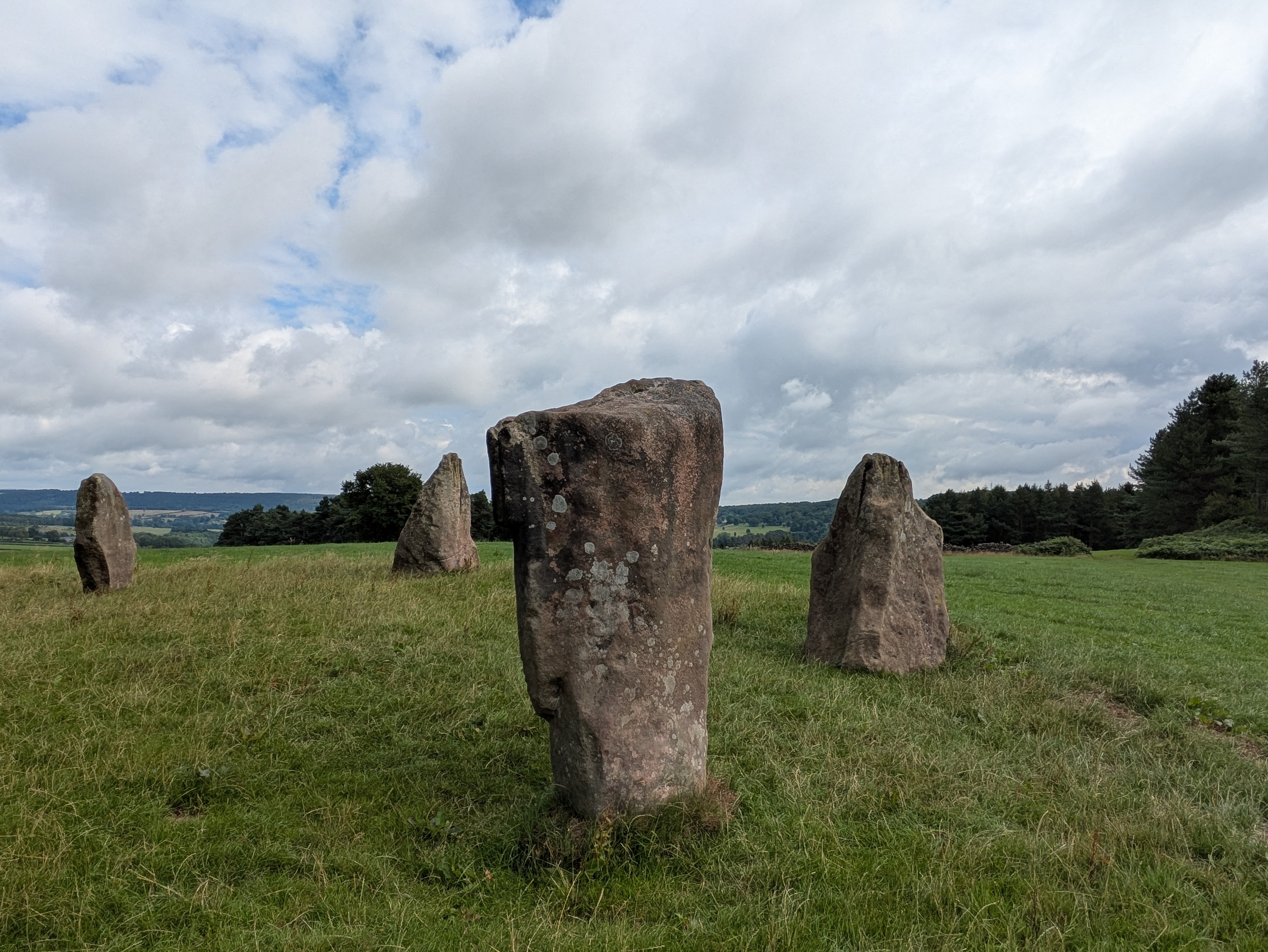
She explained that the Grey Ladies once featured more stones, some now long since pilfered for use as gateposts. The rock formation beside the circle? Robin Hood’s Stride. A name that absolutely fires the imagination, and she encouraged us to scramble around it a bit. We did. And it was fantastic. Photos barely do it justice, but standing among ancient stones with sweeping views over the dale, you couldn’t help but wonder about the stories behind them, and the stories they could tell were they able to speak.
Onward with the Wind at Our Backs
With the sky clearing, we rejoined the Limestone Way heading south. The weather had truly turned by now: fluffy clouds, warm sun, and a steady breeze—perfect conditions for walking. Jumpers and jackets were packed away, and the rhythm of the trail took over.
We cruised past Winster, ascending gently toward 1,275ft—the second highest point of the day. The trail was a welcome mix of soft grass and compacted limestone, which kept things kind on the knees. We pressed on through lunchtime, though we did take a brief break by a pub (closed, mercifully, or we might’ve stayed).
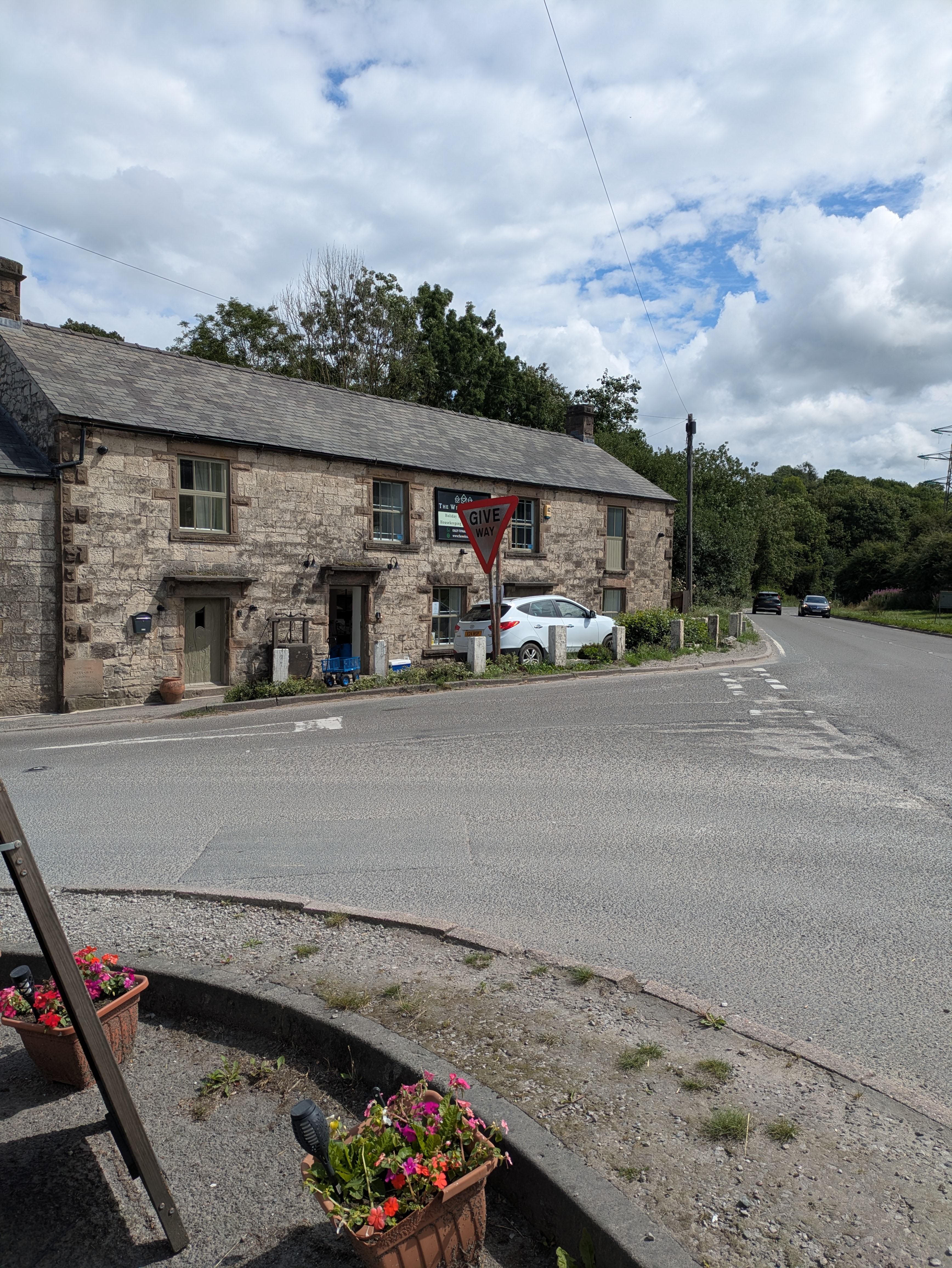
A roadside “Give Way” sign hilariously out of scale caught our attention and brought back memories of the infamous “Stonehenge” scene from Spinal Tap. If you know, you know.
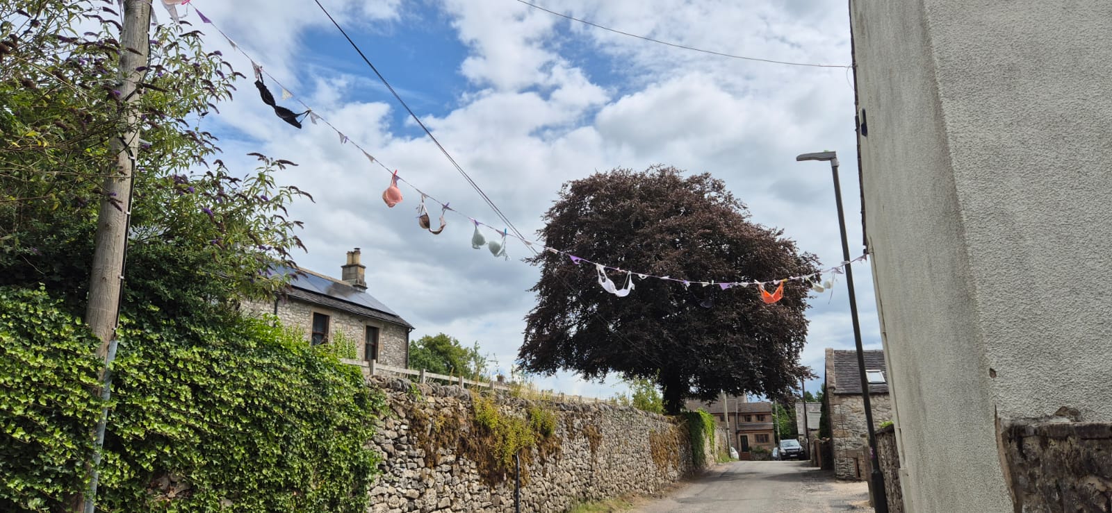
At around 7 miles in, we reached Bonsall, a quirky village with an eye for decoration. Bunting stretched across the street—but instead of flags, as we walked closer we realized it was a string of bras! We wanted to ask a local lady what the significance was, but couldn't muster the courage incase this was just an over zealous hanging out of laundry....
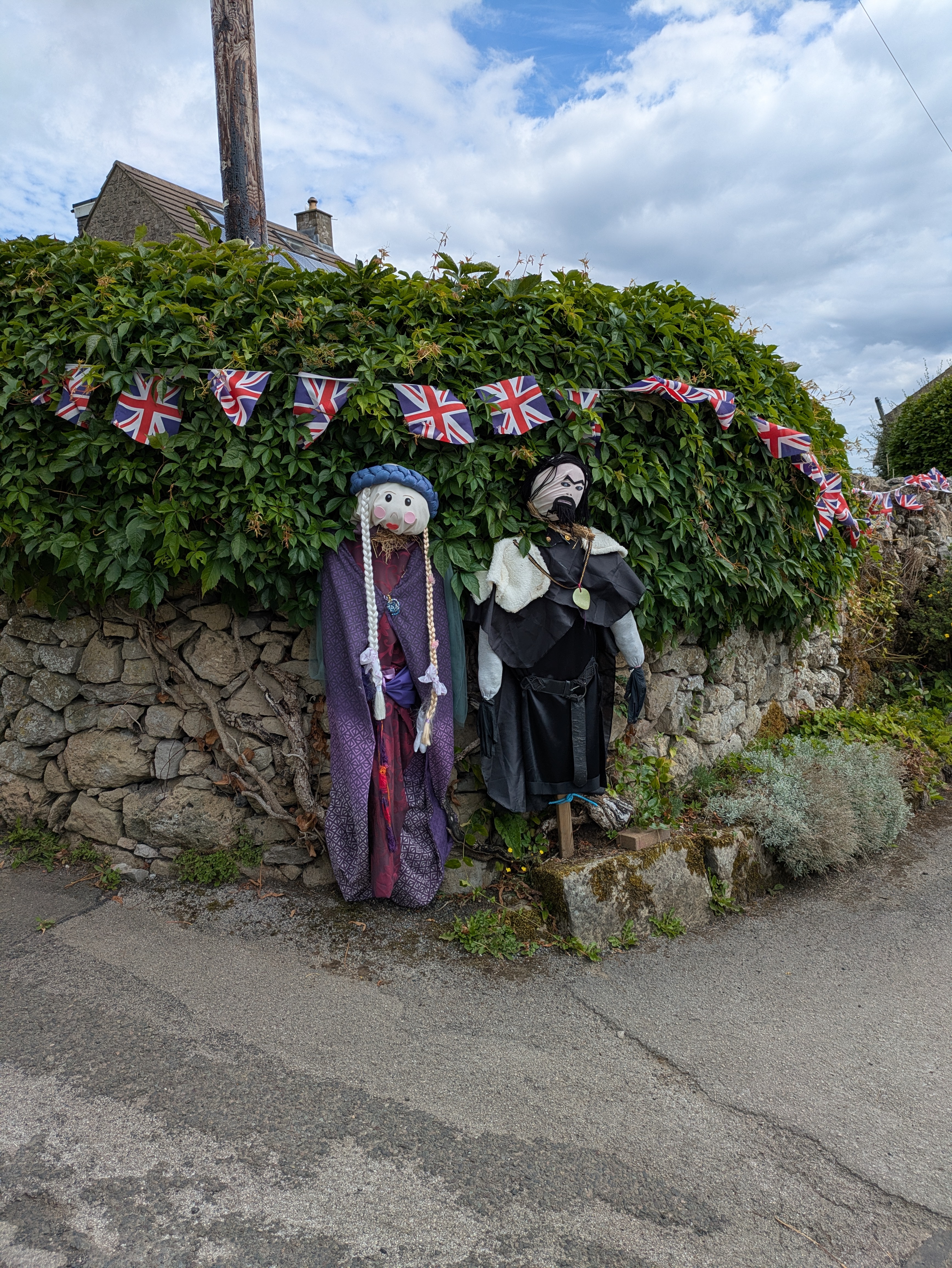
Further down the same street I also captured some odd Robin Hood-like effigies attached to a nearby gate. Clearly, the locals enjoy their craft time!
Three Climbs and a Church
The next stretch featured a series of three ascents, the peak of one at 1,300ft was the highest point today, that had Steven digging deep. We reached Brassington, our first potential stopping point, and I gave him the option to call it there—especially with the town’s pubs whispering sweet nothings to our tired legs. But Steven was having none of it. Determined to push on, we tackled a few more miles.
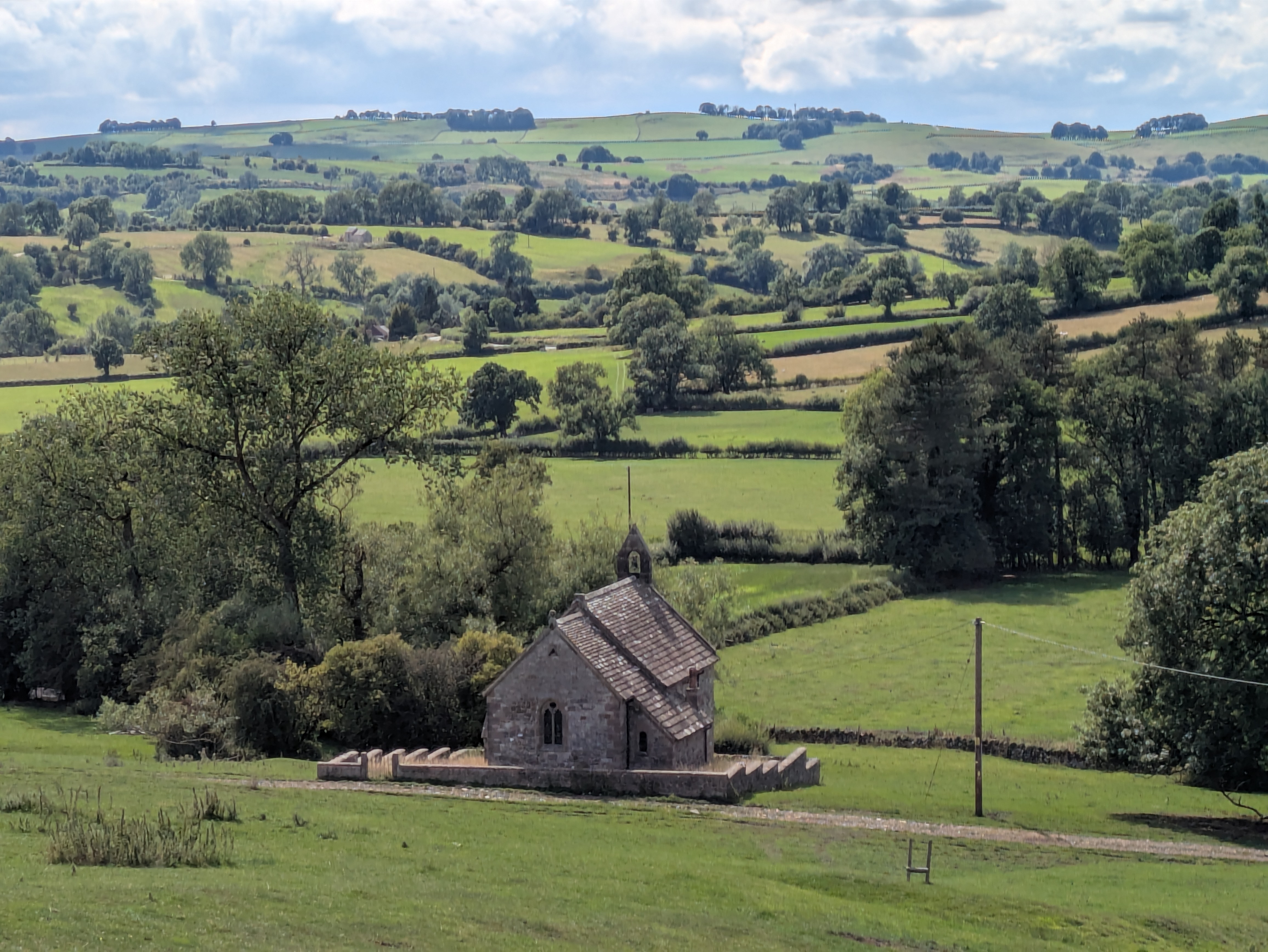
Descending toward Ballidon, the trail led us past a beautiful and solitary little church, just outside the hamlet. We couldn’t resist popping inside. Cool stone walls, quiet stillness, and a real sense of history. Ballidon, as it turns out, is listed in the Domesday Book and dates back even further—an Anglo-Saxon charter from AD 963 mentions the land being granted to a nobleman named Aethelferth.
The only drawback? No pub in sight. After soaking up the peaceful atmosphere of the church, our thirst got the better of us. We called in the extraction team, and around 40 minutes later we were sipping well-earned drinks and tucking into food with the rest of the family.
Reflections
Today’s walk was a gem—history, scenery, ancient mystery, and a strong showing from Steven, who powered through despite the climbs. The Peak District continues to impress, and the trail continues to deliver that special mix of discovery and serenity.
With feet a little tired, the weather forecast for tomorrow suggests change is afoot, the bigplod continues.....